Get FREE ground shipping in the U.S. on this item!
Original price$5,899.00
-
Original price$5,899.00
Original price
$5,899.00
$5,899.00
-
$5,899.00
Current price$5,899.00
| /
Availability:
Low stock
Key features
Ideal for precision farming and land analysis
20MP RGB + 4 x 5MP multispectral cameras for detailed RGB and multispectral data
Green, Red, Red Edge & Near Infrared Bands for advanced crop health monitoring
RTK module enables centimeter-level positioning
Omnidirectional obstacle avoidance ensures safe flights
Wide-FOV sensors adapts to sloped terrain for consistent data collection
Integrated sunlight sensor Ensures accurate multispectral data in varying light conditions
43-minute flight time for longer operations
O3 transmission gives table video feed up to 9.3 miles
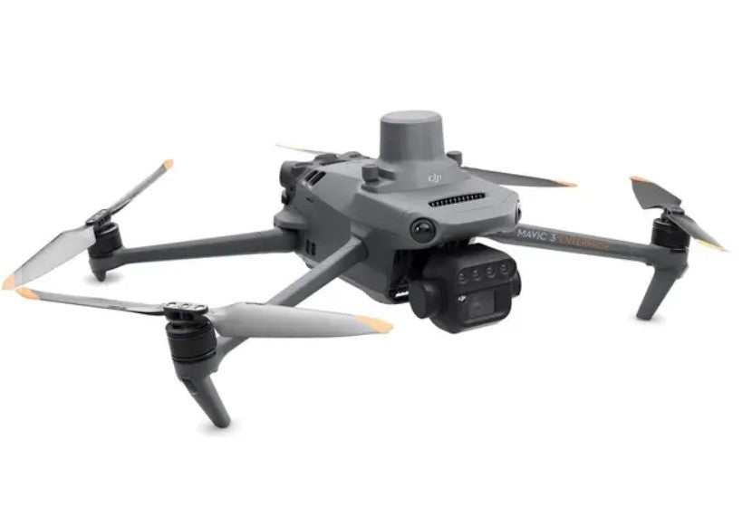
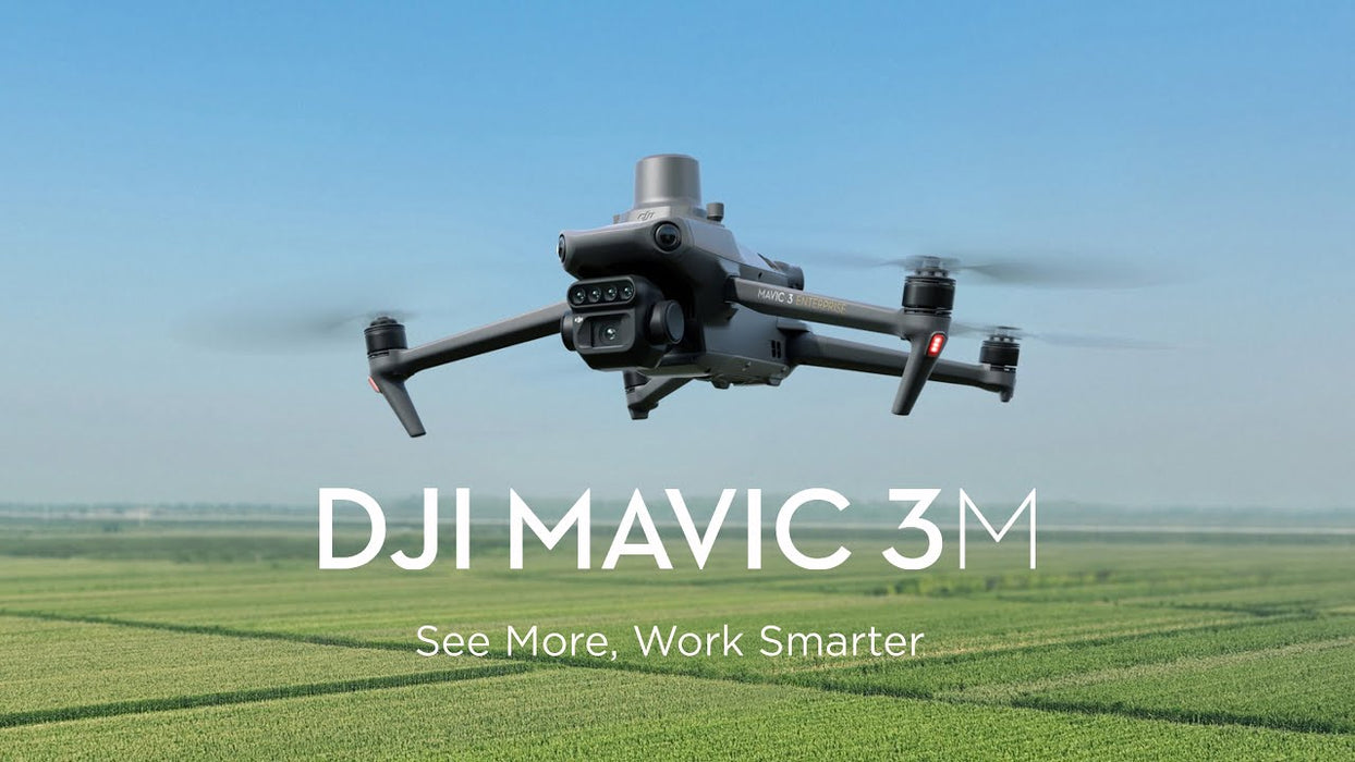
DJI Mavic 3 Multispectral (Care Basic) for exceptional aerial surveying
It takes the right set of eyes to see problems that are hidden from view. Good thing the leader in drone technology now brings you the DJI Mavic 3 Multispectral.
Power of RGB + multispectral cams
There are two ways for Mavic 3 Multispectral to see: one 20MP 4/3 CMOS RGB camera and four 5MP multispectral (green, red, red edge, and near infrared) cameras. For crystal-clear crop growth analysis, it combines an RGB camera with a multispectral camera. Mavic 3M provides the data and precision that agricultural production management demands.
Precision aerial surveying, agricultural growth monitoring, and natural resource surveys are all made possible by these improved imaging systems.
Built-in sunlight sensor
For light adjustment of picture data during 2D reconstruction, the built-in sunlight sensor in DJI Mavic 3 Multispectral records solar irradiance in an image file. As a result, the NDVI results are more accurate, and the accuracy and consistency of data collected over time are also improved.
RTK for centimeter-level positioning
An RTK module is included with Mavic 3M to enable centimeter-level positioning. To precisely pinpoint the location of each camera's imaging center, flight control, the camera, and the RTK module sync in a matter of microseconds. Mavic 3M can now carry out very accurate aerial surveying without the need for ground control points.
Ultra-long battery life
Unlike other survey drones, the DJI Mavic 3 Multispectral has a maximum flight time of 43 minutes. When fully charged, the aircraft can complete mapping operations over an area of 200 hectares in one flight.
You don’t even have to worry about getting back up in the air again because the battery supports fast charging. You can use either the 100W Battery Charging Hub for high-efficiency multi-battery fast charging or the 88W aircraft recharging.
Fly with peace of mind
Smooth image transmission and a steady signal are guaranteed by Mavic 3M. In order to achieve 15km ultra-long transmission distances, the O3 transmission integrates two transmitting signals and four receiving signals.
For another layer of safety, the drone features omnidirectional obstacle sensing and terrain-follow mode. The aircraft is equipped with several wide-FOV vision sensors, which enable obstacle avoidance by precisely detecting obstructions in all directions. In terrains with steep slopes, terrain-follow aerial surveying is simple to use.
Agricultural and natural resource applications
It’s a wonder that just one drone can be utilized in various agricultural and natural resource applications. The DJI Mavic 3 Multispectral is so powerful you can fly it for different use cases such as the following:
orchard mapping
prescription mapping for croplands
intelligent field scouting
environmental monitoring
natural resources survey (water enrichment monitoring, forest distribution surveys, urban green area surveys, and more)
1x Aircraft (RTK module and microSD card installed)
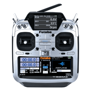
1x Remote controller
1x Pair of propellers
1x Charger
1x Power cable
1x USB-C cable
1x USB-C to USB-C cable
1x Carrying case
1x Screwdriver
1x Manuals
Aircraft
Net Weight (with propellers and RTK module): 951 g
Max Takeoff Weight: 1,050 g
Dimensions (Folded/Unfolded):
Folded: 223×96.3×122.2 mm
Unfolded: 347.5×283×139.6 mm
Diagonal Length: 380.1 mm
Max Ascent Speed:
Normal Mode: 6 m/s
Sport Mode: 8 m/s
Max Descent Speed:
Normal Mode: 6 m/s
Sport Mode: 6 m/s
Max Flight Speed:
Forward: 21 m/s
Sideways: 20 m/s
Backward: 19 m/s
Normal Mode: 15 m/s
Sport Mode:
Max Wind Speed Resistance: 12 m/s
Max Take-off Altitude Above Sea Level: 6000 m
Max Flight Time (without wind): 43 minutes
Max Hover Time (without wind): 37 minutes
Max Flight Distance: 32 km
Max Tilt Angle:
Normal Mode: 30°
Sport Mode: 35°
Max Angular Velocity: 200°/s
GNSS: GPS + Galileo + BeiDou + GLONASS
Hovering Accuracy Range:
Vertical: ±0.1 m (Vision Positioning), ±0.5 m (GNSS), ±0.1 m (D-RTK)
Horizontal: ±0.3 m (Vision Positioning), ±0.5 m (GNSS), ±0.1 m (RTK)
Operating Temperature: -10° to 40° C
Internal Storage: N/A
Motor Model Number: 2008
Propeller Model Number: 9453F Enterprise Edition
Light Sensor: Built-in module
RGB Camera
Image Sensor: 4/3 CMOS, Effective Pixels: 20 MP
Lens:
FOV: 84°
Equivalent Focal Length: 24 mm
Aperture: f/2.8 to f/11
Focus: 1 m to ∞
ISO Range: 100-6400
Shutter Speed:
Electronic Shutter: 8-1/8000 s
Mechanical Shutter: 8-1/2000 s
Max Image Size: 5280×3956
Photo Shooting Mode:
Single Shot: 20 MP
Timelapse: 20 MP
Panorama: 20 MP
Video Resolution:
4K: 3840×2160@30fps
FHD: 1920×1080@30fps
Max Video Bitrate:
4K: 130 Mbps
FHD: 70 Mbps
Supported File System: exFAT
Image Format: JPEG/DNG (RAW)
Video Format: MP4 (MPEG-4 AVC/H.264)
Multispectral Camera
Image Sensor: 1/2.8-inch CMOS, Effective Pixels: 5 MP
Lens:
FOV: 73.91°
Equivalent Focal Length: 25 mm
Aperture: f/2.0
Focus: Fixed Focus
Multispectral Camera Bands:
Green (G): 560 ± 16 nm
Red (R): 650 ± 16 nm
Red Edge (RE): 730 ± 16 nm
Near Infrared (NIR): 860 ± 26 nm
Gain Range: 1x-32x
Shutter Speed: Electronic Shutter: 1/30~1/12800 s
Max Image Size: 2592×1944
Image Format: TIFF
Video Format: MP4 (MPEG-4 AVC/H.264)
Photo Shooting Mode:
Single Shot: 5 MP
Timelapse: 5 MP
Video Resolution: FHD 1920×1080@30fps
Max Video Bitrate: 60 Mbps
Battery
Capacity: 5000 mAh
Standard Voltage: 15.4 V
Max Charging Voltage: 17.6 V
Battery Type: LiPo 4S
Chemical System: Lithium Cobalt
Energy: 77 Wh
Weight: 335.5 g
Charging Temperature: 5° to 40° C
Battery Charger
Input: 100V to 240V (AC), 50Hz to 60Hz, 2.5A
Output Power: 100 W
Output:
Max output power of 100 W (total)
Dynamic allocation for two interfaces with max output power of one interface at 82 W
RTK Module
Dimensions: 50.2×40.2×66.2 mm
Weight: 24±2 g
Interface: USB-C
Power: Approx. 1.2 W
RTK Position Accuracy:
Horizontal: 1 cm + 1 ppm
Vertical: 1.5 cm + 1 ppm