DJI Mavic 3 Multispectral Combo
New & Un-Activated Unit
This Item Ships FREE
Description
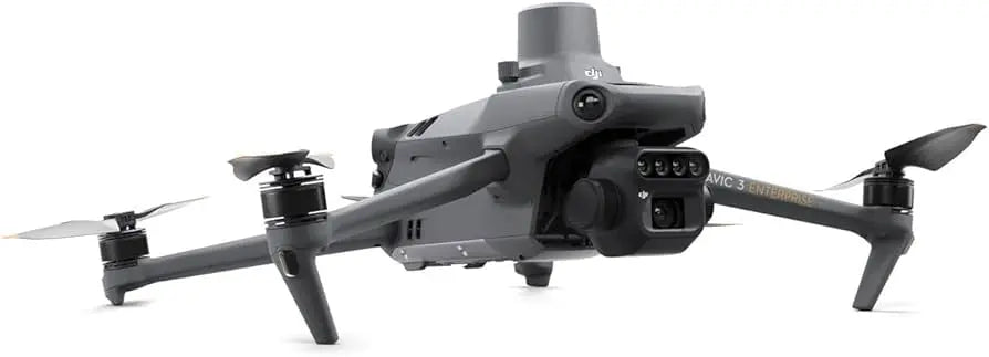
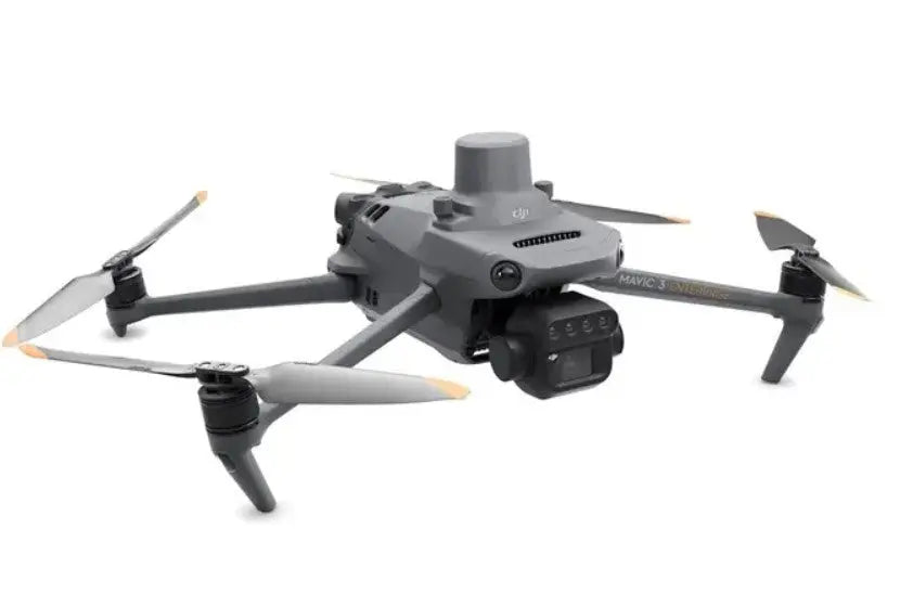
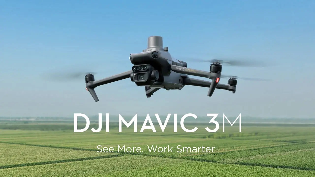
DJI Mavic 3 Multispectral for exceptional aerial surveying
It takes the right set of eyes to see problems that are hidden from view. Good thing the leader in drone technology now brings you the DJI Mavic 3 Multispectral.
Power of RGB + multispectral cams
There are two ways for Mavic 3 Multispectral to see: one 20MP 4/3 CMOS RGB camera and four 5MP multispectral (green, red, red edge, and near infrared) cameras. For crystal-clear crop growth analysis, it combines an RGB camera with a multispectral camera. Mavic 3M provides the data and precision that agricultural production management demands.
Precision aerial surveying, agricultural growth monitoring, and natural resource surveys are all made possible by these improved imaging systems.
Built-in sunlight sensor
For light adjustment of picture data during 2D reconstruction, the built-in sunlight sensor in DJI Mavic 3 Multispectral records solar irradiance in an image file. As a result, the NDVI results are more accurate, and the accuracy and consistency of data collected over time are also improved.
RTK for centimeter-level positioning
An RTK module is included with Mavic 3M to enable centimeter-level positioning. To precisely pinpoint the location of each camera's imaging center, flight control, the camera, and the RTK module sync in a matter of microseconds. Mavic 3M can now carry out very accurate aerial surveying without the need for ground control points.
Ultra-long battery life
Unlike other survey drones, the DJI Mavic 3 Multispectral has a maximum flight time of 43 minutes. When fully charged, the aircraft can complete mapping operations over an area of 200 hectares in one flight.
You don’t even have to worry about getting back up in the air again because the battery supports fast charging. You can use either the 100W Battery Charging Hub for high-efficiency multi-battery fast charging or the 88W aircraft recharging.
Fly with peace of mind
Smooth image transmission and a steady signal are guaranteed by Mavic 3M. In order to achieve 15km ultra-long transmission distances, the O3 transmission integrates two transmitting signals and four receiving signals.
For another layer of safety, the drone features omnidirectional obstacle sensing and terrain-follow mode. The aircraft is equipped with several wide-FOV vision sensors, which enable obstacle avoidance by precisely detecting obstructions in all directions. In terrains with steep slopes, terrain-follow aerial surveying is simple to use.
Agricultural and natural resource applications
It’s a wonder that just one drone can be utilized in various agricultural and natural resource applications. The DJI Mavic 3 Multispectral is so powerful you can fly it for different use cases such as the following:
- orchard mapping
- prescription mapping for croplands
- intelligent field scouting
- environmental monitoring
- natural resources survey (water enrichment monitoring, forest distribution surveys, urban green area surveys, and more)
Specifications
In The Box
DJI Mavic 3 Multispectral for exceptional aerial surveying
It takes the right set of eyes to see problems that are hidden from view. Good thing the leader in drone technology now brings you the DJI Mavic 3 Multispectral.
Power of RGB + multispectral cams
There are two ways for Mavic 3 Multispectral to see: one 20MP 4/3 CMOS RGB camera and four 5MP multispectral (green, red, red edge, and near infrared) cameras. For crystal-clear crop growth analysis, it combines an RGB camera with a multispectral camera. Mavic 3M provides the data and precision that agricultural production management demands.
Precision aerial surveying, agricultural growth monitoring, and natural resource surveys are all made possible by these improved imaging systems.
Built-in sunlight sensor
For light adjustment of picture data during 2D reconstruction, the built-in sunlight sensor in DJI Mavic 3 Multispectral records solar irradiance in an image file. As a result, the NDVI results are more accurate, and the accuracy and consistency of data collected over time are also improved.
RTK for centimeter-level positioning
An RTK module is included with Mavic 3M to enable centimeter-level positioning. To precisely pinpoint the location of each camera's imaging center, flight control, the camera, and the RTK module sync in a matter of microseconds. Mavic 3M can now carry out very accurate aerial surveying without the need for ground control points.
Ultra-long battery life
Unlike other survey drones, the DJI Mavic 3 Multispectral has a maximum flight time of 43 minutes. When fully charged, the aircraft can complete mapping operations over an area of 200 hectares in one flight.
You don’t even have to worry about getting back up in the air again because the battery supports fast charging. You can use either the 100W Battery Charging Hub for high-efficiency multi-battery fast charging or the 88W aircraft recharging.
Fly with peace of mind
Smooth image transmission and a steady signal are guaranteed by Mavic 3M. In order to achieve 15km ultra-long transmission distances, the O3 transmission integrates two transmitting signals and four receiving signals.
For another layer of safety, the drone features omnidirectional obstacle sensing and terrain-follow mode. The aircraft is equipped with several wide-FOV vision sensors, which enable obstacle avoidance by precisely detecting obstructions in all directions. In terrains with steep slopes, terrain-follow aerial surveying is simple to use.
Agricultural and natural resource applications
It’s a wonder that just one drone can be utilized in various agricultural and natural resource applications. The DJI Mavic 3 Multispectral is so powerful you can fly it for different use cases such as the following:
- orchard mapping
- prescription mapping for croplands
- intelligent field scouting
- environmental monitoring
- natural resources survey (water enrichment monitoring, forest distribution surveys, urban green area surveys, and more)
Contact Us
Questions? Need a quote?
FAQ
Check out the most common questions our customers ask. Still have questions? Contact our customer support.
Are all DJI drones the same?
No, they are not. Be careful of other sellers advertising DJI drones at bargain prices or selling only through social media or online marketplaces. Often times, these are "black market" drones intended for use in another country like Nigeria or South Africa. They are cheap because they were pre-activated overseas before being shipped. We sell un-activated models and can assist our customers with repairs.
Are you an authorized DJI and Autel dealer?
Yes, we are an authorized dealer for all the brands we sell to include DJI, Autel, JZ, CZI, and many more.
Do you offer financing on drones?
Yes! We offer financing packages through Affirm, Approve, and Shop Pay installments
Do you accept government/corporate purchases?
Yes! We sell to government and corporate/enterprise clients all the time and can accept purchase orders. Contact us today for a quote or to learn more.
Do you offer DJI drone repairs?
We do! We have partnered with Drone-Works to offer repairs on select DJI drones. Visit here for more info: DJI Repairs
How long will it take to get my order?
It depends on where you are located and the shipping method. We try to ship all orders within 1 business day. Transit time to most locations in the U.S. from us in Colorado is typically just 2-5 business days.
Do you offer local pickup?
Yes! We allow our local customers to pick up products from our Johnstown, Colorado, location. Select pickup during checkout and contact us to schedule a time.