In the rapidly evolving world of enterprise drone technology, DJI has raised the bar with its Matrice 4 Series, and the Matrice 4E stands out as a powerful, versatile aircraft built to tackle demanding professional missions. Whether you’re in surveying, construction, energy, or public safety, the 4E combines cutting-edge imaging, intelligent flight capabilities, and robust performance to streamline aerial operations.
🚀 What Sets the Matrice 4E Apart
At its core, the Matrice 4E is designed as a high-performance enterprise UAV with advanced imaging systems and smart flight tools that help professionals collect high-quality data with precision and efficiency.
Here’s what makes it noteworthy:
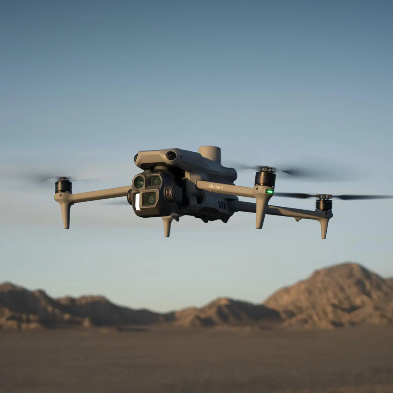
🔍 Multi-Sensor Camera System
The Matrice 4E is equipped with a tri-camera payload that gives it unmatched flexibility in aerial imaging:
-
20 MP Wide-angle camera with a 4/3″ sensor and mechanical shutter — ideal for accurate orthophoto mapping.
-
48 MP Medium telephoto lens (around 70 mm) for closer inspections.
-
48 MP Telephoto lens (around 168 mm) capable of resolving fine details from afar — useful for inspecting infrastructure like bridges and power lines.
This combo lets operators capture detailed imagery for mapping, structural analysis, and professional documentation, all from a single flight.
🛰️ Intelligent Flight and AI Features
DJI has packed the Matrice 4E with smart functions powered by onboard AI, such as:
-
Smart detection of people, vehicles, and objects to enhance situational awareness.
-
FlyTo, Smart Track, POI, and Cruise intelligent flight modes, which help automate complex missions and keep subjects in frame.
-
Smart 3D Capture, enabling users to create quick 3D models to automatically plan optimized flight paths for detailed mapping.
These capabilities make it easier for operators to conduct consistent, repeatable missions with less pilot workload.
🗺️ Designed for Surveying, Mapping & Inspection
The Matrice 4E excels in data-driven tasks thanks to features like:
-
Rapid 0.5s interval shooting for high coverage during mapping flights.
-
High-speed capture up to 21 m/s with orthophoto and oblique modes for efficient data collection.
-
Laser range finder and RTK support for precise distance measurement and improved positional accuracy.
In practical terms, that means fewer flight passes, faster processing, and data you can trust — especially in land development, construction monitoring, and topographic mapping.
⏱️ Endurance & Performance
For enterprise operators, flight time and reliability matter — and the Matrice 4E delivers:
-
Up to ~49 minutes of flight time, allowing you to cover larger areas in a single mission.
-
Strong wind resistance and stable hover performance help maintain mission quality in real-world conditions.
Combined with DJI’s O4 Enterprise transmission system, long-distance connectivity and high-quality live video feeds make field coordination seamless.
🧠 Safety and Navigation
Enterprise missions often occur in complex or GPS-challenged environments. DJI has equipped the Matrice 4E with:
-
Omnidirectional sensing and obstacle avoidance that detects hazards from all directions.
-
GNSS + Vision Fusion navigation for reliable positioning, even with poor satellite signals.
-
Return-to-home and automatic rerouting features for safe flight completion.
These systems not only protect your investment but also allow operators to plan more complex missions with confidence.
💡 Real-World Use Cases
Operators around the world are leveraging the Matrice 4E for:
-
Precision surveying and 3D modeling for urban planning and civil engineering.
-
Infrastructure inspection (e.g., roads, bridges, power lines) with detailed telephoto imaging.
-
Construction progress documentation with high-resolution orthophotos.
-
Environmental monitoring and land management tasks requiring accurate aerial data.
Professional users also report that many automated capture features like Smart Oblique and Smart 3D Capture significantly reduce mission planning and flight time, though real-world performance can vary by environment and operator skill.
🔧 Final Thoughts
The DJI Matrice 4E is more than just a camera drone — it’s a powerful enterprise platform engineered for professionals who need precise, reliable aerial data. From surveying and mapping to inspection and beyond, it packs considerable capability into a compact, intelligent aircraft.
Whether you’re expanding your drone service offerings or upgrading your enterprise fleet, the Matrice 4E represents a major step forward in aerospace technology for commercial operators. Its combination of long flight times, advanced sensing, and intelligent automation makes it a tool worth serious consideration for mission-critical aerial work.
Leave a comment
All comments are moderated before being published.
This site is protected by hCaptcha and the hCaptcha Privacy Policy and Terms of Service apply.