DJI Terra Software Subscription | Drone Mapping & 3D Modeling Licenses
Description
DJI Terra Software Subscription | Drone Mapping & 3D Modeling Licenses
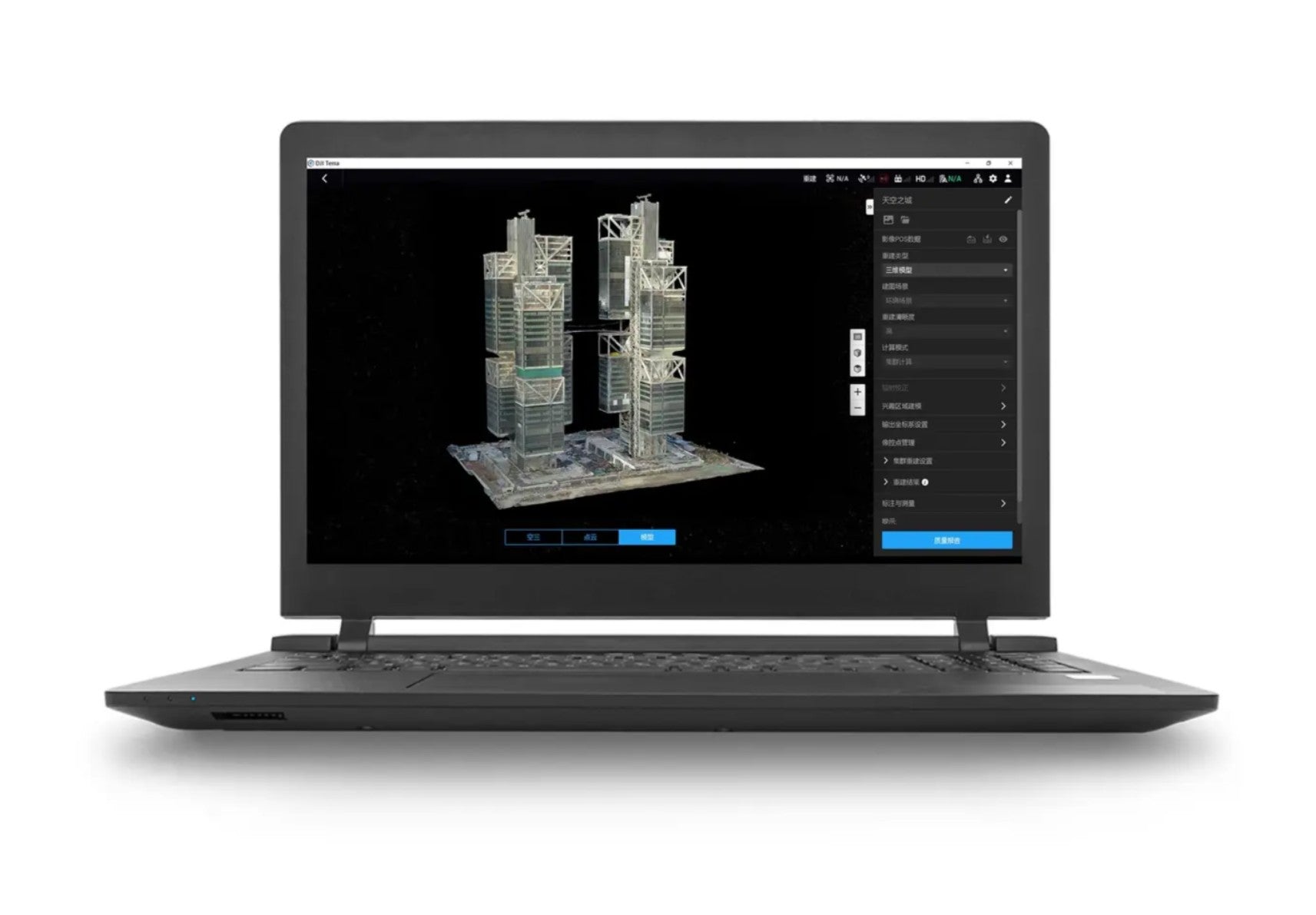
Unlock professional drone mapping, 2D reconstruction, 3D modeling, and data processing with a DJI Terra Software Subscription. Designed for enterprise drone workflows, DJI Terra helps turn aerial imagery into accurate digital maps, models, point clouds, and reconstruction outputs for surveying, construction, inspection, public safety, agriculture, and infrastructure projects.
This DJI Terra subscription gives professionals access to powerful mapping and modeling tools built for efficient drone data processing. Create detailed 2D orthomosaics, generate realistic 3D models, process aerial survey data, and streamline mapping missions with DJI’s trusted software ecosystem.
Key Features:
- DJI Terra software subscription license
- Drone mapping and 3D reconstruction tools
- Supports professional aerial surveying workflows
- Create 2D maps, 3D models, and reconstruction outputs
- Ideal for construction, inspection, public safety, agriculture, and mapping professionals
- Designed for DJI Enterprise drone data processing
Upgrade your drone operations with DJI Terra and turn flight data into actionable digital assets.
Specifications
In the box
DJI Terra Software Subscription | Drone Mapping & 3D Modeling Licenses
Unlock professional drone mapping, 2D reconstruction, 3D modeling, and data processing with a DJI Terra Software Subscription. Designed for enterprise drone workflows, DJI Terra helps turn aerial imagery into accurate digital maps, models, point clouds, and reconstruction outputs for surveying, construction, inspection, public safety, agriculture, and infrastructure projects.
This DJI Terra subscription gives professionals access to powerful mapping and modeling tools built for efficient drone data processing. Create detailed 2D orthomosaics, generate realistic 3D models, process aerial survey data, and streamline mapping missions with DJI’s trusted software ecosystem.
Key Features:
- DJI Terra software subscription license
- Drone mapping and 3D reconstruction tools
- Supports professional aerial surveying workflows
- Create 2D maps, 3D models, and reconstruction outputs
- Ideal for construction, inspection, public safety, agriculture, and mapping professionals
- Designed for DJI Enterprise drone data processing
Upgrade your drone operations with DJI Terra and turn flight data into actionable digital assets.