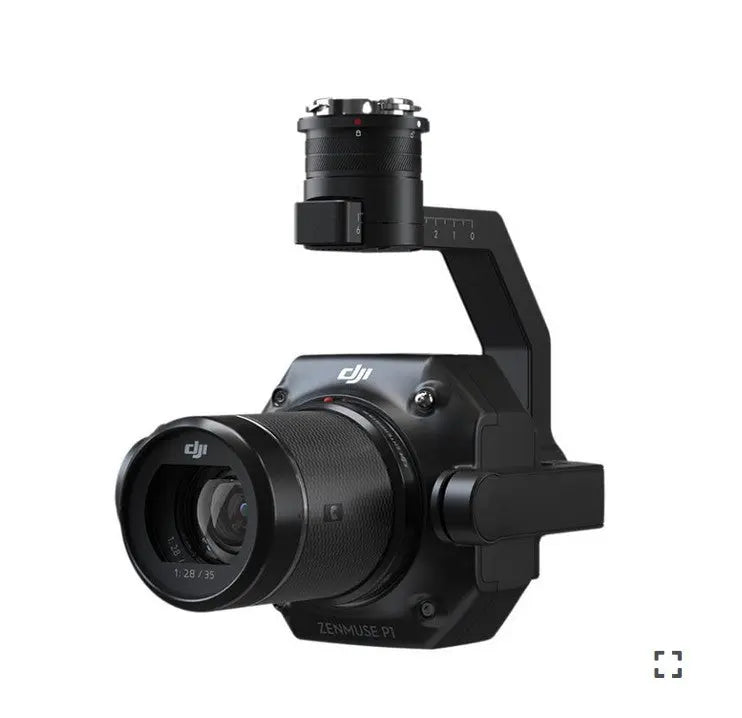
DJI Zenmuse P1 Camera Sensor
This Item Ships FREE
Description
Redefining Precision in Aerial Surveying
The Zenmuse P1 combines a full-frame sensor with interchangeable fixed-focus lenses on a 3-axis stabilized gimbal, setting a new standard for photogrammetry missions. Experience unmatched accuracy and efficiency with this advanced tool.
- Precision Without GCPs: Achieve horizontal accuracy of 3 cm and vertical accuracy of 5 cm for dependable results.
- Enhanced Coverage: Survey up to 3 km² in a single flight, maximizing productivity.
- Unrivaled Imaging Power: Capture stunning detail with a 45MP full-frame sensor.
- Stable Operation: Utilize a 3-axis stabilized gimbal with Smart Oblique Capture for smooth functionality.
- Fast Shutter Response: Global mechanical shutter captures crisp visuals at 1/2000 seconds.
- Perfect Synchronization: TimeSync 2.0 aligns all modules with microsecond precision.
The Ultimate Tool for Photogrammetry Experts
Streamlined Efficiency The Zenmuse P1's full-frame sensor minimizes noise and improves sensitivity, allowing it to capture a photo every 0.7 seconds. Covering up to 3 km² in one mission, it redefines large-scale surveying.
Exceptional Accuracy With a global mechanical shutter and TimeSync 2.0, the P1 ensures precise data alignment across all modules. Real-time position and orientation compensation delivers centimeter-level accuracy.
Unmatched Versatility Outfit the 3-axis stabilized gimbal with 24/35/50mm lenses to create 2D maps, 3D models, and detailed reconstructions. Smart Oblique Capture optimizes workflows by automating essential image angles.
Performance That Covers It All - Full-Frame Camera
- High-Resolution Sensor: The 45MP full-frame sensor with 4.4µm pixel size ensures superior image clarity.
- Extended Operation: Low-noise imaging extends flight duration, capturing data for longer periods.
- Rapid Imaging: Capture photos every 0.7 seconds for high-speed data acquisition.
- Precision Alignment: TimeSync 2.0 ensures flawless synchronization of camera, RTK module, flight controller, and gimbal.
Adaptability at Its Finest - Fixed-Focus Lens Options
- Global Mechanical Shutter: Achieve distortion-free images with a shutter speed of 1/2000 seconds.
- Versatile Lens Compatibility: Use 24mm, 35mm, and 50mm lenses with DJI DL mounts to tailor your setup.
- Microsecond Timing: Median exposure pulse ensures precise data capture.
Work Smarter, Deliver Faster
Revolutionize Your Workflow with Smart Oblique Capture Achieve up to 7.5 km² coverage in a single day using the P1. Maximize the effectiveness of your oblique photography missions with Smart Oblique Capture. This advanced feature automates gimbal rotation to capture images at precise angles required for reconstruction.
At the flight area's edges, only critical images for reconstruction are captured, streamlining your post-processing tasks and improving efficiency by 20% to 50%.
Effortless Data Management
Simplify Your Mission Workflow Take the hassle out of managing mission data with intelligent features designed to keep you organized:
- Automatically associate result files with mission names and timestamps.
- Centralize the storage of photos, GNSS data, and TimeStamps.MRK files.
- Access comprehensive image metadata, including the camera's intrinsic and extrinsic parameters and RTK status.
On-the-Spot Field Verification
Check Data Quality Instantly Ensure the accuracy of your results before leaving the field. Review critical post-flight metrics, such as:
- Image Positioning Data: Verify the number and location of images captured.
- RTK Accuracy: Confirm RTK status and positional precision.
With immediate access to these insights, you can validate the success of your mission in real-time, ensuring data integrity and saving time.
Tailored Mission Modes for Every Task
Accurate 2D Mapping Generate orthomosaics without GCPs, perfect for surveying medium to large areas.
Efficient 3D Oblique Modeling Capture oblique images from multiple angles for precise 3D models tailored to urban planning, cadastral surveys, and smart city designs.
High-Resolution Modeling Acquire detailed data of vertical and slanted surfaces for geological surveys, heritage preservation, and hydraulic engineering.
Real-Time Geographic Mapping Use DJI Terra to gather and analyze data on-site, supporting critical decision-making during operations.
Precision in Action: Unlocking the P1's Potential
- Surveying and Mapping: Create high-resolution maps and 3D models for urban planning, construction, and land management with ease.
- Infrastructure Inspections: Monitor roads, bridges, and power lines with detailed imagery to identify issues early and prevent hazards.
- Detailed 3D Models: Support archaeological preservation, digital reconstructions, and heritage site conservation with unparalleled detail.
- Environmental Analysis: Track ecosystem changes, assess deforestation, and survey wildlife habitats to support conservation efforts.
The Zenmuse P1 delivers precision, efficiency, and adaptability, redefining the standards for aerial surveying.
Why DSLRPros Stands Out
At DSLRPros, we offer drone solutions tailored to meet your unique industry challenges.
- Smart Solutions: Customized tools for agriculture, construction, and public safety.
- Industry-Focused Expertise: Strategies built to address sector-specific needs.
- Premium Gear: Drones like the DJI Phantom for unmatched performance.
- Secure Data Management: Scalable, compliant systems you can depend on.
- Dedicated Training: Professional guidance to ensure mission success.
Specifications
General
- Product Name: Zenmuse P1
- Dimensions: 198×166×129 mm
- Weight: Approx. 787 g
- Power: 13 W
- IP Rating: IP4X
- Supported Aircraft: Matrice 300 RTK
- Operating Temperature Range: -20° to 50° C (-4° to 122° F)
- Storage Temperature Range: -20° to 60° C (-4° to 140° F)
- Absolute Accuracy: Horizontal: 3 cm, Vertical: 5 cm *(Using Mapping Mission at a GSD of 3 cm and flight speed of 15 m/s, with an 75% front overlap rate and a 55% side overlap rate.)
Camera
- Sensor: Sensor size (Still): 35.9×24 mm (Full frame) ; Sensor size (Max video recording area): 34×19 mm ; Effective Pixels: 45MP ; Pixel size: 4.4 μm
- Supported Lenses: DJI DL 24mm F2.8 LS ASPH (with lens hood and balancing ring/filter), FOV 84° ; DJI DL 35mm F2.8 LS ASPH (with lens hood and balancing ring/filter), FOV 63.5° ; DJI DL 50mm F2.8 LS ASPH (with lens hood and balancing ring/filter), FOV 46.8°
- Supported SD Cards: SD: UHS-1 rating or above; Max capacity: 128 GB
- Storage Files: Photo / GNSS Raw Observation Data/ Image Log File
- Photo Size: 3:2 (8192×5460)
- Operation Modes: Capture, Record, Playback
- Minimum photo interval: 0.7 s
- Shutter Speed: Mechanical Shutter Speed: 1/2000-1/8 s ; Electronic Shutter Speed: 1/8000-8 s
- Aperture Range: f/2.8-f/16
- ISO Range: Photo: 100-25600 ; Video: 100-3200
Video
- Video Format: MP4
- Video Resolution: 16:9 (3840×2160)
- Frame Rate: 60fps
Gimbal
- Stabilized System: 3-axis (tilt, roll, pan)
- Angular Vibration Range: 0.01°
- Mount: Detachable DJI SKYPORT
- Mechanical Range: Tilt: -125° to +40°; Roll: -55° to +55°; Pan: ±320°
In the Box
- 1x Zenmuse P1
- 1x DJI Terra Mapping Software (free trial for 6 months)
- 35mm Lens with Sensor
Specifications
In The Box
Redefining Precision in Aerial Surveying
The Zenmuse P1 combines a full-frame sensor with interchangeable fixed-focus lenses on a 3-axis stabilized gimbal, setting a new standard for photogrammetry missions. Experience unmatched accuracy and efficiency with this advanced tool.
- Precision Without GCPs: Achieve horizontal accuracy of 3 cm and vertical accuracy of 5 cm for dependable results.
- Enhanced Coverage: Survey up to 3 km² in a single flight, maximizing productivity.
- Unrivaled Imaging Power: Capture stunning detail with a 45MP full-frame sensor.
- Stable Operation: Utilize a 3-axis stabilized gimbal with Smart Oblique Capture for smooth functionality.
- Fast Shutter Response: Global mechanical shutter captures crisp visuals at 1/2000 seconds.
- Perfect Synchronization: TimeSync 2.0 aligns all modules with microsecond precision.
The Ultimate Tool for Photogrammetry Experts
Streamlined Efficiency The Zenmuse P1's full-frame sensor minimizes noise and improves sensitivity, allowing it to capture a photo every 0.7 seconds. Covering up to 3 km² in one mission, it redefines large-scale surveying.
Exceptional Accuracy With a global mechanical shutter and TimeSync 2.0, the P1 ensures precise data alignment across all modules. Real-time position and orientation compensation delivers centimeter-level accuracy.
Unmatched Versatility Outfit the 3-axis stabilized gimbal with 24/35/50mm lenses to create 2D maps, 3D models, and detailed reconstructions. Smart Oblique Capture optimizes workflows by automating essential image angles.
Performance That Covers It All - Full-Frame Camera
- High-Resolution Sensor: The 45MP full-frame sensor with 4.4µm pixel size ensures superior image clarity.
- Extended Operation: Low-noise imaging extends flight duration, capturing data for longer periods.
- Rapid Imaging: Capture photos every 0.7 seconds for high-speed data acquisition.
- Precision Alignment: TimeSync 2.0 ensures flawless synchronization of camera, RTK module, flight controller, and gimbal.
Adaptability at Its Finest - Fixed-Focus Lens Options
- Global Mechanical Shutter: Achieve distortion-free images with a shutter speed of 1/2000 seconds.
- Versatile Lens Compatibility: Use 24mm, 35mm, and 50mm lenses with DJI DL mounts to tailor your setup.
- Microsecond Timing: Median exposure pulse ensures precise data capture.
Work Smarter, Deliver Faster
Revolutionize Your Workflow with Smart Oblique Capture Achieve up to 7.5 km² coverage in a single day using the P1. Maximize the effectiveness of your oblique photography missions with Smart Oblique Capture. This advanced feature automates gimbal rotation to capture images at precise angles required for reconstruction.
At the flight area's edges, only critical images for reconstruction are captured, streamlining your post-processing tasks and improving efficiency by 20% to 50%.
Effortless Data Management
Simplify Your Mission Workflow Take the hassle out of managing mission data with intelligent features designed to keep you organized:
- Automatically associate result files with mission names and timestamps.
- Centralize the storage of photos, GNSS data, and TimeStamps.MRK files.
- Access comprehensive image metadata, including the camera's intrinsic and extrinsic parameters and RTK status.
On-the-Spot Field Verification
Check Data Quality Instantly Ensure the accuracy of your results before leaving the field. Review critical post-flight metrics, such as:
- Image Positioning Data: Verify the number and location of images captured.
- RTK Accuracy: Confirm RTK status and positional precision.
With immediate access to these insights, you can validate the success of your mission in real-time, ensuring data integrity and saving time.
Tailored Mission Modes for Every Task
Accurate 2D Mapping Generate orthomosaics without GCPs, perfect for surveying medium to large areas.
Efficient 3D Oblique Modeling Capture oblique images from multiple angles for precise 3D models tailored to urban planning, cadastral surveys, and smart city designs.
High-Resolution Modeling Acquire detailed data of vertical and slanted surfaces for geological surveys, heritage preservation, and hydraulic engineering.
Real-Time Geographic Mapping Use DJI Terra to gather and analyze data on-site, supporting critical decision-making during operations.
Precision in Action: Unlocking the P1's Potential
- Surveying and Mapping: Create high-resolution maps and 3D models for urban planning, construction, and land management with ease.
- Infrastructure Inspections: Monitor roads, bridges, and power lines with detailed imagery to identify issues early and prevent hazards.
- Detailed 3D Models: Support archaeological preservation, digital reconstructions, and heritage site conservation with unparalleled detail.
- Environmental Analysis: Track ecosystem changes, assess deforestation, and survey wildlife habitats to support conservation efforts.
The Zenmuse P1 delivers precision, efficiency, and adaptability, redefining the standards for aerial surveying.
Why DSLRPros Stands Out
At DSLRPros, we offer drone solutions tailored to meet your unique industry challenges.
- Smart Solutions: Customized tools for agriculture, construction, and public safety.
- Industry-Focused Expertise: Strategies built to address sector-specific needs.
- Premium Gear: Drones like the DJI Phantom for unmatched performance.
- Secure Data Management: Scalable, compliant systems you can depend on.
- Dedicated Training: Professional guidance to ensure mission success.
Specifications
General
- Product Name: Zenmuse P1
- Dimensions: 198×166×129 mm
- Weight: Approx. 787 g
- Power: 13 W
- IP Rating: IP4X
- Supported Aircraft: Matrice 300 RTK
- Operating Temperature Range: -20° to 50° C (-4° to 122° F)
- Storage Temperature Range: -20° to 60° C (-4° to 140° F)
- Absolute Accuracy: Horizontal: 3 cm, Vertical: 5 cm *(Using Mapping Mission at a GSD of 3 cm and flight speed of 15 m/s, with an 75% front overlap rate and a 55% side overlap rate.)
Camera
- Sensor: Sensor size (Still): 35.9×24 mm (Full frame) ; Sensor size (Max video recording area): 34×19 mm ; Effective Pixels: 45MP ; Pixel size: 4.4 μm
- Supported Lenses: DJI DL 24mm F2.8 LS ASPH (with lens hood and balancing ring/filter), FOV 84° ; DJI DL 35mm F2.8 LS ASPH (with lens hood and balancing ring/filter), FOV 63.5° ; DJI DL 50mm F2.8 LS ASPH (with lens hood and balancing ring/filter), FOV 46.8°
- Supported SD Cards: SD: UHS-1 rating or above; Max capacity: 128 GB
- Storage Files: Photo / GNSS Raw Observation Data/ Image Log File
- Photo Size: 3:2 (8192×5460)
- Operation Modes: Capture, Record, Playback
- Minimum photo interval: 0.7 s
- Shutter Speed: Mechanical Shutter Speed: 1/2000-1/8 s ; Electronic Shutter Speed: 1/8000-8 s
- Aperture Range: f/2.8-f/16
- ISO Range: Photo: 100-25600 ; Video: 100-3200
Video
- Video Format: MP4
- Video Resolution: 16:9 (3840×2160)
- Frame Rate: 60fps
Gimbal
- Stabilized System: 3-axis (tilt, roll, pan)
- Angular Vibration Range: 0.01°
- Mount: Detachable DJI SKYPORT
- Mechanical Range: Tilt: -125° to +40°; Roll: -55° to +55°; Pan: ±320°
In the Box
- 1x Zenmuse P1
- 1x DJI Terra Mapping Software (free trial for 6 months)
- 35mm Lens with Sensor
Contact Us
Questions? Need a quote?
FAQ
Check out the most common questions our customers ask. Still have questions? Contact our customer support.
Are all DJI drones the same?
No, they are not. Be careful of other sellers advertising DJI drones at bargain prices or selling only through social media or online marketplaces. Often times, these are "black market" drones intended for use in another country like Nigeria or South Africa. They are cheap because they were pre-activated overseas before being shipped. We sell un-activated models and can assist our customers with repairs.
Are you an authorized DJI and Autel dealer?
Yes, we are an authorized dealer for all the brands we sell to include DJI, Autel, JZ, CZI, and many more.
Do you offer financing on drones?
Do you accept government/corporate purchases?
Yes! We sell to government and corporate/enterprise clients all the time and can accept purchase orders. Contact us today for a quote or to learn more.
Do you offer DJI drone repairs?
We do! We have partnered with Drone-Works to offer repairs on select DJI drones. Visit here for more info: DJI Repairs
How long will it take to get my order?
It depends on where you are located and the shipping method. We try to ship all orders within 1 business day. Transit time to most locations in the U.S. from us in Colorado is typically just 2-5 business days.
Do you offer local pickup?
Yes! We allow our local customers to pick up products from our Johnstown, Colorado, location. Select pickup during checkout and contact us to schedule a time.