Emlid Reach RS3 RTK GNSS Receiver for Enterprise Drone Operations
This Item Ships FREE
Description
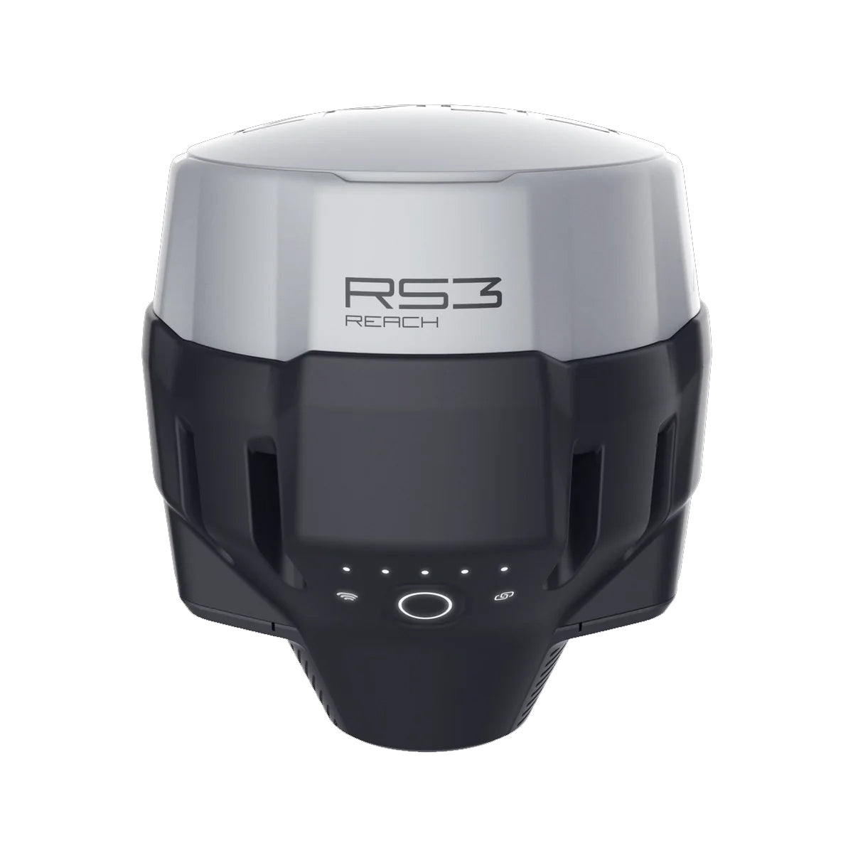
Emlid Reach RS3 GNSS Receiver
The Emlid Reach RS3 is a high-performance multi-band GNSS receiver designed for survey-grade positioning in demanding field environments. Built for precision, speed, and reliability, it delivers centimeter-level accuracy for drone mapping, land surveying, construction layout, and geospatial data collection workflows.

Advanced Multi-Band RTK Performance
The Reach RS3 supports multi-band GNSS signals, enabling fast and stable RTK fixes even in challenging environments such as urban areas, tree cover, or variable terrain. Its advanced positioning engine improves convergence time and maintains consistent accuracy, making it ideal for time-sensitive surveying missions.
Tilt Compensation for Faster Field Work
One of the key advantages of the Reach RS3 is integrated IMU-based tilt compensation, allowing users to capture precise measurements without needing to perfectly level the pole. This significantly increases efficiency in the field, especially in hard-to-reach or obstructed survey points.
Built for Drone and Ground Survey Integration
While widely used as a ground rover or base station, the Reach RS3 integrates seamlessly into drone mapping workflows. It supports both RTK and PPK setups, making it a versatile tool for UAV operators who require consistent geotagging accuracy and reduced reliance on ground control points.
Rugged, Portable, and Field-Ready
Designed for real-world conditions, the Reach RS3 features a ruggedized housing with high environmental resistance, long battery life, and simple mobile app control. Its compact design makes it easy to deploy across multiple job sites without complex setup procedures.
Reliable Survey-Grade Accuracy
For professionals in surveying, GIS, agriculture, and infrastructure inspection, the Emlid Reach RS3 delivers dependable centimeter-level positioning that helps improve data quality, reduce rework, and streamline field operations.
Multi-band RTK GNSS receiver with tilt compensation
Survey grade precision even in hard-to-reach spots. Acts as a base or rover. Comes with a mobile app.
Specifications
In The Box
Emlid Reach RS3 GNSS Receiver
The Emlid Reach RS3 is a high-performance multi-band GNSS receiver designed for survey-grade positioning in demanding field environments. Built for precision, speed, and reliability, it delivers centimeter-level accuracy for drone mapping, land surveying, construction layout, and geospatial data collection workflows.
Advanced Multi-Band RTK Performance
The Reach RS3 supports multi-band GNSS signals, enabling fast and stable RTK fixes even in challenging environments such as urban areas, tree cover, or variable terrain. Its advanced positioning engine improves convergence time and maintains consistent accuracy, making it ideal for time-sensitive surveying missions.
Tilt Compensation for Faster Field Work
One of the key advantages of the Reach RS3 is integrated IMU-based tilt compensation, allowing users to capture precise measurements without needing to perfectly level the pole. This significantly increases efficiency in the field, especially in hard-to-reach or obstructed survey points.
Built for Drone and Ground Survey Integration
While widely used as a ground rover or base station, the Reach RS3 integrates seamlessly into drone mapping workflows. It supports both RTK and PPK setups, making it a versatile tool for UAV operators who require consistent geotagging accuracy and reduced reliance on ground control points.
Rugged, Portable, and Field-Ready
Designed for real-world conditions, the Reach RS3 features a ruggedized housing with high environmental resistance, long battery life, and simple mobile app control. Its compact design makes it easy to deploy across multiple job sites without complex setup procedures.
Reliable Survey-Grade Accuracy
For professionals in surveying, GIS, agriculture, and infrastructure inspection, the Emlid Reach RS3 delivers dependable centimeter-level positioning that helps improve data quality, reduce rework, and streamline field operations.
Multi-band RTK GNSS receiver with tilt compensation
Survey grade precision even in hard-to-reach spots. Acts as a base or rover. Comes with a mobile app.
Contact Us
Questions? Need a quote?
FAQ
Check out the most common questions our customers ask. Still have questions? Contact our customer support.
Are all DJI drones the same?
No, they are not. Be careful of other sellers advertising DJI drones at bargain prices or selling only through social media or online marketplaces. Often times, these are "black market" drones intended for use in another country like Nigeria or South Africa. They are cheap because they were pre-activated overseas before being shipped. We sell un-activated models and can assist our customers with repairs.
Are you an authorized DJI and Autel dealer?
Yes, we are an authorized dealer for all the brands we sell to include DJI, Autel, JZ, CZI, and many more.
Do you offer financing on drones?
Do you accept government/corporate purchases?
Yes! We sell to government and corporate/enterprise clients all the time and can accept purchase orders. Contact us today for a quote or to learn more.
Do you offer DJI drone repairs?
We do! We have partnered with Drone-Works to offer repairs on select DJI drones. Visit here for more info: DJI Repairs
How long will it take to get my order?
It depends on where you are located and the shipping method. We try to ship all orders within 1 business day. Transit time to most locations in the U.S. from us in Colorado is typically just 2-5 business days.
Do you offer local pickup?
Yes! We allow our local customers to pick up products from our Johnstown, Colorado, location. Select pickup during checkout and contact us to schedule a time.