CZI MF30-M4 Drone Flow Meter for DJI Matrice 4 Series
This Item Ships FREE

Description
CZI MF30-M4 Drone Flow Meter: Compact UAV Payload for Real-Time Surface Velocity and Flow Measurement on the DJI Matrice 4 Series
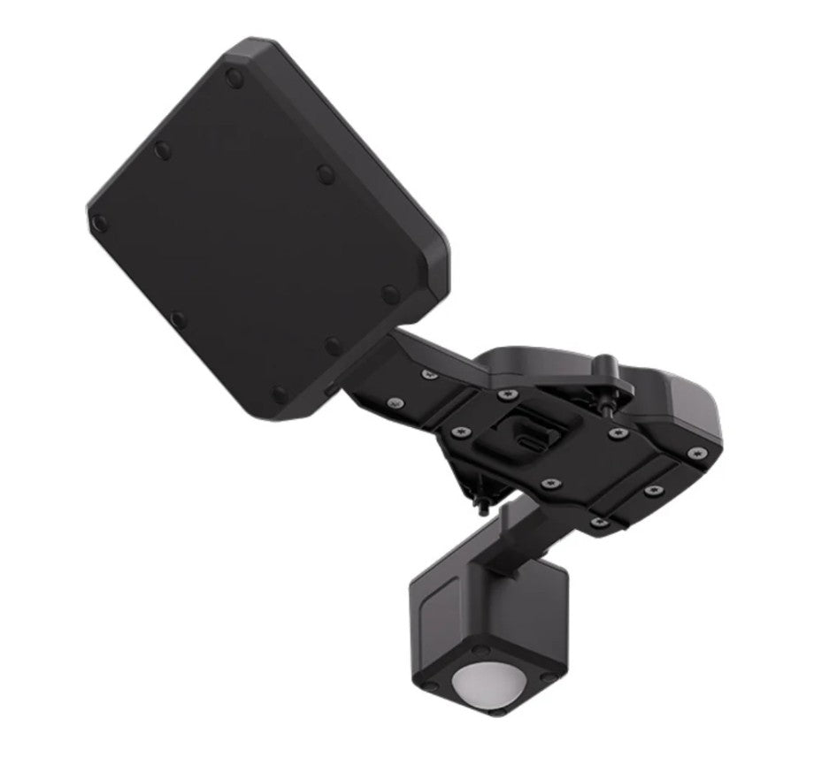
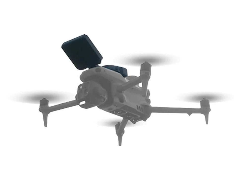
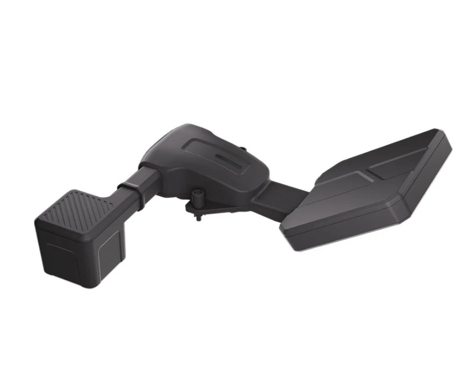
The CZI MF30-M4 is a compact drone-mounted flow meter payload designed for rapid surface water velocity measurement and flow calculation on the DJI Matrice 4 Series. Developed by CZI for emergency hydrological monitoring and routine water conservancy surveys, it integrates a 24GHz velocity radar and an 80GHz ranging radar into a single 108g payload that mounts directly to the Matrice 4 via PSDK.
A single operator can complete installation and deployment in under two minutes, making it a practical tool for flood response teams that need actionable flow data quickly and without complex ground-based equipment.
The velocity radar measures surface flow speeds from 0.1 to 20 m/s with accuracy of ±0.01 m/s at speeds below 1 m/s and ≤±1% full scale at speeds above 1 m/s, operating at a recommended measurement height of 1 to 10m above the water surface. The 80GHz ranging radar measures water surface distance from 0.18 to 30m with ±2mm ranging accuracy, enabling the system to compute reference water levels in real time.
All data displays live on the remote controller through DJI Pilot, while the full feature set — including automated flight missions, river cross-section flow calculation, data export, and cloud synchronization — is available through CZI Pilot software running on the drone controller.
CZI MF30-M4 Core Features and Advantages
- 24GHz velocity radar: measures surface flow from 0.1 to 20 m/s with ±0.01 m/s accuracy.
- 80GHz ranging radar: water surface distance measurement from 0.18 to 30m at ±2mm accuracy.
- Lightweight design: 108g payload mounts to DJI Matrice 4 via PSDK for fast field deployment.
- Two-minute setup: single operator can install and deploy the payload in under two minutes.
- CZI Pilot software: complete flow monitoring from measurement to calculation and data export.
- Automated flight missions: route-based automatic flight records all measurement point data.
- Reference water level: supports Pearl River, Wusong, and other benchmark calculation systems.
- Flow calculation: Area-Velocity, International, and Liwen methods supported for cross-section flow.
- Cloud synchronization: flow data syncs to cloud platform for visualization and data management.
- IP55 rated: sealed against dust and water jets for field deployment in light to moderate rain.
Applications and Use Cases
- Flood emergency response: rapidly measure breach flow velocity at river upstream points during flood events, giving response teams actionable hydrological data within minutes of arrival without ground-based equipment.
- Routine hydrological surveys: import river cross-section data and conduct scheduled surface velocity measurements at fixed monitoring points to support ongoing water resource management and reporting.
- River cross-section flow calculation: combine measured velocity data with imported cross-section profiles to compute volumetric flow rates using Area-Velocity, International, or Liwen calculation methods.
- Water level monitoring: use the 80GHz ranging radar alongside RTK elevation data to calculate reference water levels relative to established benchmarks such as Pearl River or Wusong datum.
- Disaster reconnaissance: deploy rapidly over inaccessible or hazardous waterways during disaster events to collect flow and water level data that ground teams cannot safely reach.
- Dam and reservoir management: conduct scheduled flow measurements upstream and downstream of dams and reservoirs to support discharge management, spillway operations, and safety monitoring.
- Irrigation and agriculture water management: measure flow rates in irrigation channels and agricultural water supply systems to support water allocation decisions and efficiency monitoring.
- Environmental monitoring: collect surface velocity and water level data in rivers and wetlands for ecological research, habitat assessment, and environmental compliance reporting.
- Urban stormwater management: measure flow velocity in urban drainage channels and stormwater systems during and after heavy rain events to support drainage capacity analysis and flood risk assessment.
- Bridge and infrastructure inspection support: measure flow conditions near bridge piers, culverts, and hydraulic structures to assess scour risk and support infrastructure safety evaluations.
The CZI MF30-M4 exists for water resource professionals who need fast, reliable surface flow data from a drone without the logistical burden of traditional ground-based measurement equipment. Its 108g weight, two-minute deployment time, and integrated CZI Pilot software pipeline make it a practical primary tool for flood emergency response teams and routine hydrological survey programs operating on DJI Matrice 4 Series platforms.
Specifications
In The Box
CZI MF30-M4 Drone Flow Meter: Compact UAV Payload for Real-Time Surface Velocity and Flow Measurement on the DJI Matrice 4 Series
The CZI MF30-M4 is a compact drone-mounted flow meter payload designed for rapid surface water velocity measurement and flow calculation on the DJI Matrice 4 Series. Developed by CZI for emergency hydrological monitoring and routine water conservancy surveys, it integrates a 24GHz velocity radar and an 80GHz ranging radar into a single 108g payload that mounts directly to the Matrice 4 via PSDK.
A single operator can complete installation and deployment in under two minutes, making it a practical tool for flood response teams that need actionable flow data quickly and without complex ground-based equipment.
The velocity radar measures surface flow speeds from 0.1 to 20 m/s with accuracy of ±0.01 m/s at speeds below 1 m/s and ≤±1% full scale at speeds above 1 m/s, operating at a recommended measurement height of 1 to 10m above the water surface. The 80GHz ranging radar measures water surface distance from 0.18 to 30m with ±2mm ranging accuracy, enabling the system to compute reference water levels in real time.
All data displays live on the remote controller through DJI Pilot, while the full feature set — including automated flight missions, river cross-section flow calculation, data export, and cloud synchronization — is available through CZI Pilot software running on the drone controller.
CZI MF30-M4 Core Features and Advantages
- 24GHz velocity radar: measures surface flow from 0.1 to 20 m/s with ±0.01 m/s accuracy.
- 80GHz ranging radar: water surface distance measurement from 0.18 to 30m at ±2mm accuracy.
- Lightweight design: 108g payload mounts to DJI Matrice 4 via PSDK for fast field deployment.
- Two-minute setup: single operator can install and deploy the payload in under two minutes.
- CZI Pilot software: complete flow monitoring from measurement to calculation and data export.
- Automated flight missions: route-based automatic flight records all measurement point data.
- Reference water level: supports Pearl River, Wusong, and other benchmark calculation systems.
- Flow calculation: Area-Velocity, International, and Liwen methods supported for cross-section flow.
- Cloud synchronization: flow data syncs to cloud platform for visualization and data management.
- IP55 rated: sealed against dust and water jets for field deployment in light to moderate rain.
Applications and Use Cases
- Flood emergency response: rapidly measure breach flow velocity at river upstream points during flood events, giving response teams actionable hydrological data within minutes of arrival without ground-based equipment.
- Routine hydrological surveys: import river cross-section data and conduct scheduled surface velocity measurements at fixed monitoring points to support ongoing water resource management and reporting.
- River cross-section flow calculation: combine measured velocity data with imported cross-section profiles to compute volumetric flow rates using Area-Velocity, International, or Liwen calculation methods.
- Water level monitoring: use the 80GHz ranging radar alongside RTK elevation data to calculate reference water levels relative to established benchmarks such as Pearl River or Wusong datum.
- Disaster reconnaissance: deploy rapidly over inaccessible or hazardous waterways during disaster events to collect flow and water level data that ground teams cannot safely reach.
- Dam and reservoir management: conduct scheduled flow measurements upstream and downstream of dams and reservoirs to support discharge management, spillway operations, and safety monitoring.
- Irrigation and agriculture water management: measure flow rates in irrigation channels and agricultural water supply systems to support water allocation decisions and efficiency monitoring.
- Environmental monitoring: collect surface velocity and water level data in rivers and wetlands for ecological research, habitat assessment, and environmental compliance reporting.
- Urban stormwater management: measure flow velocity in urban drainage channels and stormwater systems during and after heavy rain events to support drainage capacity analysis and flood risk assessment.
- Bridge and infrastructure inspection support: measure flow conditions near bridge piers, culverts, and hydraulic structures to assess scour risk and support infrastructure safety evaluations.
The CZI MF30-M4 exists for water resource professionals who need fast, reliable surface flow data from a drone without the logistical burden of traditional ground-based measurement equipment. Its 108g weight, two-minute deployment time, and integrated CZI Pilot software pipeline make it a practical primary tool for flood emergency response teams and routine hydrological survey programs operating on DJI Matrice 4 Series platforms.
Contact Us
Questions? Need a quote?
FAQ
Check out the most common questions our customers ask. Still have questions? Contact our customer support.
Are all DJI drones the same?
No, they are not. Be careful of other sellers advertising DJI drones at bargain prices or selling only through social media or online marketplaces. Often times, these are "black market" drones intended for use in another country like Nigeria or South Africa. They are cheap because they were pre-activated overseas before being shipped. We sell un-activated models and can assist our customers with repairs.
Are you an authorized DJI and Autel dealer?
Yes, we are an authorized dealer for all the brands we sell to include DJI, Autel, JZ, CZI, and many more.
Do you offer financing on drones?
Do you accept government/corporate purchases?
Yes! We sell to government and corporate/enterprise clients all the time and can accept purchase orders. Contact us today for a quote or to learn more.
Do you offer DJI drone repairs?
We do! We have partnered with Drone-Works to offer repairs on select DJI drones. Visit here for more info: DJI Repairs
How long will it take to get my order?
It depends on where you are located and the shipping method. We try to ship all orders within 1 business day. Transit time to most locations in the U.S. from us in Colorado is typically just 2-5 business days.
Do you offer local pickup?
Yes! We allow our local customers to pick up products from our Johnstown, Colorado, location. Select pickup during checkout and contact us to schedule a time.