DJI D-RTK 3 Multifunctional Station
This Item Ships FREE

Description
DJI D-RTK 3 Multifunctional Station: Revolution Precision
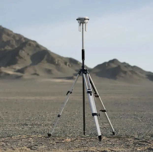
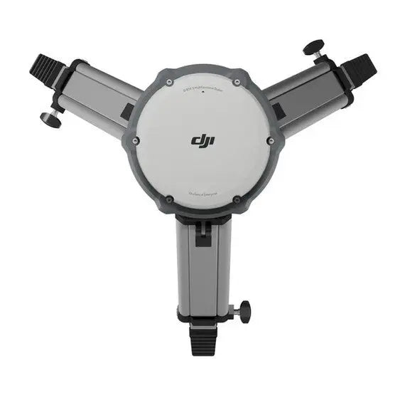
The DJI D-RTK 3 Multifunctional Station is an advanced positioning solution for professional drone operations, combining high-performance antennas, GNSS receiver modules, and an inertial measurement unit to deliver unparalleled accuracy and reliability. Designed to support multiple drones simultaneously, it provides centimeter-level positioning when used as a base station and extends operational range in relay station mode. Its innovative rover station mode integrates seamlessly with the DJI ENTERPRISE app and DJI Terra, making it the perfect tool for high-precision aerial surveying and mapping.

Key Features and Benefits
- Centimeter-Level Positioning: Provides ultra-precise positioning data for multiple drones simultaneously, ensuring accuracy in complex missions.
-
Multi-Mode Functionality:
Base Station Mode: Achieve real-time, centimeter-level positioning for fleet operations.
Relay Station Mode: Extend operational range with transmission distances of up to 15 km (FCC standard).
Rover Station Mode: Ideal for high-precision aerial surveying when paired with DJI ENTERPRISE app and DJI Terra.
- Advanced GNSS Compatibility: Tracks data from major global satellite systems, including GPS, GLONASS, Galileo, BDS, and QZSS, for reliable performance worldwide.
- High-Performance IMU: Built-in inertial measurement unit ensures accurate orientation and positioning even in challenging conditions.
- Durable Design: IP67-rated construction protects against dust and water, making it suitable for rugged environments.
- Easy Setup and Operation: Compact, lightweight design with intuitive integration for hassle-free deployment.
Applications and Use Cases
The DJI D-RTK 3 Multifunctional Station is perfect for:
- Aerial Surveying and Mapping: Capture precise geospatial data with centimeter-level accuracy.
- Agriculture and Land Management: Conduct detailed field surveys and optimize crop management.
- Infrastructure Inspections: Perform accurate assessments of bridges, towers, and other structures.
- Search and Rescue Operations: Enhance range and precision for critical missions in remote areas.
Specifications
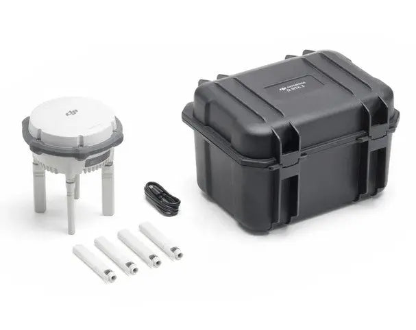
In The Box
DJI D-RTK 3 Multifunctional Station: Revolution Precision
The DJI D-RTK 3 Multifunctional Station is an advanced positioning solution for professional drone operations, combining high-performance antennas, GNSS receiver modules, and an inertial measurement unit to deliver unparalleled accuracy and reliability. Designed to support multiple drones simultaneously, it provides centimeter-level positioning when used as a base station and extends operational range in relay station mode. Its innovative rover station mode integrates seamlessly with the DJI ENTERPRISE app and DJI Terra, making it the perfect tool for high-precision aerial surveying and mapping.
Key Features and Benefits
- Centimeter-Level Positioning: Provides ultra-precise positioning data for multiple drones simultaneously, ensuring accuracy in complex missions.
-
Multi-Mode Functionality:
Base Station Mode: Achieve real-time, centimeter-level positioning for fleet operations.
Relay Station Mode: Extend operational range with transmission distances of up to 15 km (FCC standard).
Rover Station Mode: Ideal for high-precision aerial surveying when paired with DJI ENTERPRISE app and DJI Terra.
- Advanced GNSS Compatibility: Tracks data from major global satellite systems, including GPS, GLONASS, Galileo, BDS, and QZSS, for reliable performance worldwide.
- High-Performance IMU: Built-in inertial measurement unit ensures accurate orientation and positioning even in challenging conditions.
- Durable Design: IP67-rated construction protects against dust and water, making it suitable for rugged environments.
- Easy Setup and Operation: Compact, lightweight design with intuitive integration for hassle-free deployment.
Applications and Use Cases
The DJI D-RTK 3 Multifunctional Station is perfect for:
- Aerial Surveying and Mapping: Capture precise geospatial data with centimeter-level accuracy.
- Agriculture and Land Management: Conduct detailed field surveys and optimize crop management.
- Infrastructure Inspections: Perform accurate assessments of bridges, towers, and other structures.
- Search and Rescue Operations: Enhance range and precision for critical missions in remote areas.
Contact Us
Questions? Need a quote?
FAQ
Check out the most common questions our customers ask. Still have questions? Contact our customer support.
Are all DJI drones the same?
No, they are not. Be careful of other sellers advertising DJI drones at bargain prices or selling only through social media or online marketplaces. Often times, these are "black market" drones intended for use in another country like Nigeria or South Africa. They are cheap because they were pre-activated overseas before being shipped. We sell un-activated models and can assist our customers with repairs.
Are you an authorized DJI and Autel dealer?
Yes, we are an authorized dealer for all the brands we sell to include DJI, Autel, JZ, CZI, and many more.
Do you offer financing on drones?
Do you accept government/corporate purchases?
Yes! We sell to government and corporate/enterprise clients all the time and can accept purchase orders. Contact us today for a quote or to learn more.
Do you offer DJI drone repairs?
We do! We have partnered with Drone-Works to offer repairs on select DJI drones. Visit here for more info: DJI Repairs
How long will it take to get my order?
It depends on where you are located and the shipping method. We try to ship all orders within 1 business day. Transit time to most locations in the U.S. from us in Colorado is typically just 2-5 business days.
Do you offer local pickup?
Yes! We allow our local customers to pick up products from our Johnstown, Colorado, location. Select pickup during checkout and contact us to schedule a time.