DJI Matrice 4D (Drone Only - Dock Version)
New & Un-Activated Unit
This Item Ships FREE

Description
DJI Matrice 4D: Workhorse Enterprise Mapping Drone System
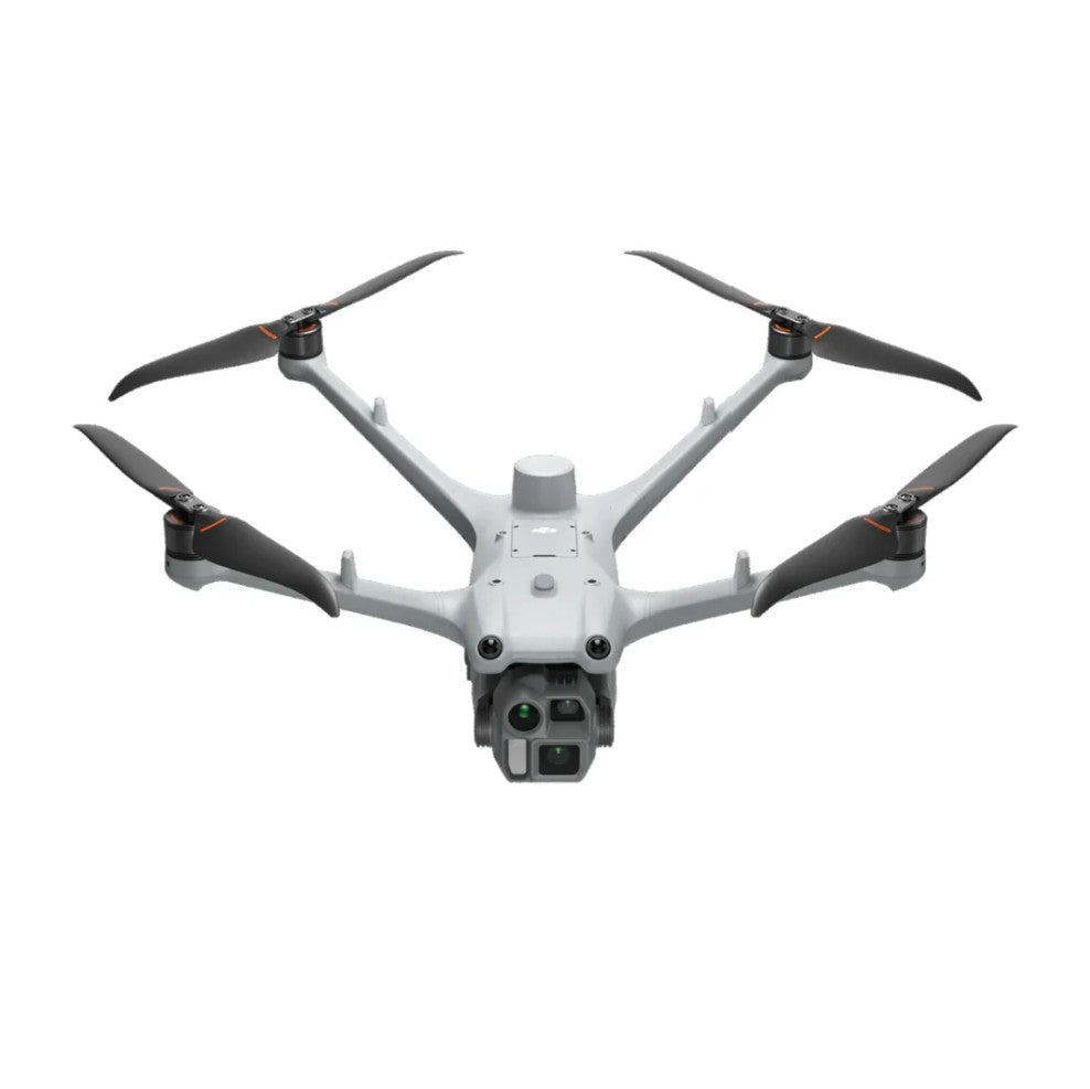
The DJI Matrice 4D is an enterprise UAV aircraft designed for long-endurance aerial inspection, mapping, and public safety operations. Built around a tri-camera imaging system and laser range finder, the aircraft enables operators to capture high-resolution visual data and measure distant objects with precision.
With up to 54 minutes of flight time and an IP55-rated airframe, the Matrice 4D is engineered to operate reliably in demanding environments across industries including infrastructure inspection, energy, public safety, and surveying.
This aircraft-only configuration provides the core Matrice 4D platform without the battery or remote controller, allowing organizations to integrate the aircraft into existing enterprise fleets or dock-based systems. The platform supports RTK positioning, advanced obstacle sensing, and the DJI O4 Enterprise transmission system for long-range operations and reliable mission execution.
Key Features and Benefits
- Tri-camera imaging system: wide, medium tele, and tele cameras support inspection and mapping missions
- 4/3 CMOS wide camera: 20 MP sensor with mechanical shutter for photogrammetry workflows
- 48 MP telephoto cameras: medium and long zoom sensors enable detailed remote inspection
- Laser range finder: measures target distance accurately from 1 to 1,800 meters
- Long flight endurance: up to 54 minutes forward flight for extended missions
- IP55-rated airframe: designed for reliable operation in rain, dust, and harsh environments
- RTK positioning system: supports centimeter-level positioning for precision mapping missions
- O4 Enterprise transmission: stable video and control link with extended operational range
- Advanced sensing system: multi-directional vision and infrared sensors support obstacle detection
- Dock compatibility: designed for automated deployment with DJI Dock 3 infrastructure
Extended Endurance for Large-Scale Operations
The Matrice 4D is built to support large-area inspection and mapping missions where endurance, positioning accuracy, and sensor capability are critical. With forward flight endurance reaching 54 minutes, operators can cover larger corridors and infrastructure assets without frequent battery changes.
The integrated RTK module supports centimeter-level positioning accuracy for survey-grade workflows, while the DJI O4 Enterprise transmission system provides reliable command and video links over long distances. Combined with a tri-camera system and laser range finder, the aircraft enables operators to identify, measure, and document assets with precision while maintaining safe standoff distances.
Compatibility and System Integration
- DJI RC Plus 2 Enterprise: required remote controller for standalone aircraft operation
- DJI Dock 3: supports automated drone deployment, landing, and battery charging infrastructure
- DJI Pilot 2: flight control software used for aircraft configuration and mission execution
- DJI FlightHub 2: cloud platform for remote fleet management and mission monitoring
- Custom Network RTK: supports NTRIP service for centimeter-level positioning accuracy
- D-RTK 3 relay station: optional accessory providing enhanced RTK positioning reliability
Applications and Use Cases
- Infrastructure inspection: assess power lines, towers, and bridges using high-resolution tele cameras
- Public safety operations: support search and rescue with long endurance aerial monitoring
- Surveying and mapping: capture precise aerial imagery for photogrammetry and mapping workflows
- Energy sector inspection: monitor oil, gas, and energy infrastructure safely from distance
- Construction monitoring: document site progress and capture accurate aerial project data
- Environmental monitoring: observe wildlife habitats, coastlines, and protected areas remotely
The DJI Matrice 4D provides enterprise operators with a powerful aerial platform capable of performing complex inspection and mapping missions efficiently. Its combination of long flight endurance, precision positioning, and advanced imaging sensors allows teams to gather critical data safely and reliably in demanding operational environments.
Specifications
In The Box
DJI Matrice 4D: Workhorse Enterprise Mapping Drone System
The DJI Matrice 4D is an enterprise UAV aircraft designed for long-endurance aerial inspection, mapping, and public safety operations. Built around a tri-camera imaging system and laser range finder, the aircraft enables operators to capture high-resolution visual data and measure distant objects with precision.
With up to 54 minutes of flight time and an IP55-rated airframe, the Matrice 4D is engineered to operate reliably in demanding environments across industries including infrastructure inspection, energy, public safety, and surveying.
This aircraft-only configuration provides the core Matrice 4D platform without the battery or remote controller, allowing organizations to integrate the aircraft into existing enterprise fleets or dock-based systems. The platform supports RTK positioning, advanced obstacle sensing, and the DJI O4 Enterprise transmission system for long-range operations and reliable mission execution.
Key Features and Benefits
- Tri-camera imaging system: wide, medium tele, and tele cameras support inspection and mapping missions
- 4/3 CMOS wide camera: 20 MP sensor with mechanical shutter for photogrammetry workflows
- 48 MP telephoto cameras: medium and long zoom sensors enable detailed remote inspection
- Laser range finder: measures target distance accurately from 1 to 1,800 meters
- Long flight endurance: up to 54 minutes forward flight for extended missions
- IP55-rated airframe: designed for reliable operation in rain, dust, and harsh environments
- RTK positioning system: supports centimeter-level positioning for precision mapping missions
- O4 Enterprise transmission: stable video and control link with extended operational range
- Advanced sensing system: multi-directional vision and infrared sensors support obstacle detection
- Dock compatibility: designed for automated deployment with DJI Dock 3 infrastructure
Extended Endurance for Large-Scale Operations
The Matrice 4D is built to support large-area inspection and mapping missions where endurance, positioning accuracy, and sensor capability are critical. With forward flight endurance reaching 54 minutes, operators can cover larger corridors and infrastructure assets without frequent battery changes.
The integrated RTK module supports centimeter-level positioning accuracy for survey-grade workflows, while the DJI O4 Enterprise transmission system provides reliable command and video links over long distances. Combined with a tri-camera system and laser range finder, the aircraft enables operators to identify, measure, and document assets with precision while maintaining safe standoff distances.
Compatibility and System Integration
- DJI RC Plus 2 Enterprise: required remote controller for standalone aircraft operation
- DJI Dock 3: supports automated drone deployment, landing, and battery charging infrastructure
- DJI Pilot 2: flight control software used for aircraft configuration and mission execution
- DJI FlightHub 2: cloud platform for remote fleet management and mission monitoring
- Custom Network RTK: supports NTRIP service for centimeter-level positioning accuracy
- D-RTK 3 relay station: optional accessory providing enhanced RTK positioning reliability
Applications and Use Cases
- Infrastructure inspection: assess power lines, towers, and bridges using high-resolution tele cameras
- Public safety operations: support search and rescue with long endurance aerial monitoring
- Surveying and mapping: capture precise aerial imagery for photogrammetry and mapping workflows
- Energy sector inspection: monitor oil, gas, and energy infrastructure safely from distance
- Construction monitoring: document site progress and capture accurate aerial project data
- Environmental monitoring: observe wildlife habitats, coastlines, and protected areas remotely
The DJI Matrice 4D provides enterprise operators with a powerful aerial platform capable of performing complex inspection and mapping missions efficiently. Its combination of long flight endurance, precision positioning, and advanced imaging sensors allows teams to gather critical data safely and reliably in demanding operational environments.
Contact Us
Questions? Need a quote?
FAQ
Check out the most common questions our customers ask. Still have questions? Contact our customer support.
Are all DJI drones the same?
No, they are not. Be careful of other sellers advertising DJI drones at bargain prices or selling only through social media or online marketplaces. Often times, these are "black market" drones intended for use in another country like Nigeria or South Africa. They are cheap because they were pre-activated overseas before being shipped. We sell un-activated models and can assist our customers with repairs.
Are you an authorized DJI and Autel dealer?
Yes, we are an authorized dealer for all the brands we sell to include DJI, Autel, JZ, CZI, and many more.
Do you offer financing on drones?
Do you accept government/corporate purchases?
Yes! We sell to government and corporate/enterprise clients all the time and can accept purchase orders. Contact us today for a quote or to learn more.
Do you offer DJI drone repairs?
We do! We have partnered with Drone-Works to offer repairs on select DJI drones. Visit here for more info: DJI Repairs
How long will it take to get my order?
It depends on where you are located and the shipping method. We try to ship all orders within 1 business day. Transit time to most locations in the U.S. from us in Colorado is typically just 2-5 business days.
Do you offer local pickup?
Yes! We allow our local customers to pick up products from our Johnstown, Colorado, location. Select pickup during checkout and contact us to schedule a time.